
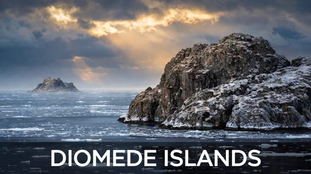
Stand on the shore of Little Diomede on a Monday morning, look across the water, and you are staring straight into Tuesday. The island in front of you sits just 2.4 miles away — closer than many people’s drive to the grocery store — yet it is already living in tomorrow. No science fiction is needed. This is the real, everyday geography of the Diomede Islands, two small rocks in the Bering Strait where the map, the calendar, and two countries all collide in one narrow gap of cold sea.
The Diomede Islands are one of those places that sound made up the first time you hear about them. Two islands, side by side, split by an international border and by the International Date Line at the same time. One belongs to the United States. The other belongs to Russia. And because of where the date line falls, they are almost a full day apart — 21 hours in winter, 20 in summer — even though you could see one from the other on a clear day.
This guide covers where the Diomede Islands are, why they sit on different days, who lives there, how the border was drawn, and what daily life looks like on one of the most remote inhabited islands in America.
The short answer: The Diomede Islands are two rocky islands in the middle of the Bering Strait — Big Diomede in Russia and Little Diomede in Alaska, USA. They sit only 3.8 kilometres (2.4 miles) apart, but the International Date Line runs between them, so Big Diomede is 21 hours ahead of Little Diomede in winter (20 hours in summer). That is why they are nicknamed Tomorrow Island and Yesterday Island.
Where Are the Diomede Islands?
The Diomede Islands sit in the middle of the Bering Strait, the narrow stretch of sea that separates Alaska from Siberia. On a map, they are almost exactly halfway between the two mainlands. The Bering Strait itself is about 82 kilometres wide at its narrowest point, and the closest distance between mainland Alaska and mainland Russia is roughly 85 kilometres (53 miles). The Diomedes sit right in that gap, like two stepping stones that never quite meet.
Their position is extreme in more ways than one. The islands lie just south of the Arctic Circle, at about 65.8 degrees north latitude, in a part of the world where winter brings long darkness, sea ice, and storms that can shut down travel for days. There are no roads to the Diomede Islands, no ferry service, and no bridge. You get there by small plane or helicopter when the weather allows, or by boat in the short ice-free summer.
Two Islands, One Strait
The pair could hardly be more different in character, even though they share the same cold water and the same treeless, rocky profile. Big Diomede is the larger of the two, covering about 29 square kilometres. Little Diomede covers only about 7.3 square kilometres. Both are steep, barren, and battered by wind for much of the year — not the kind of islands people picture when they think of island life, but the kind that have shaped the history of the far north.
How Far Apart Are the Diomede Islands?
At their closest points, the two islands are 3.8 kilometres apart — about 2.4 miles. To put that in perspective, it is a shorter distance than many people walk in a morning. It is also the shortest distance between the United States and Russia anywhere on Earth. And yet that short stretch of water holds two lines at once: the maritime border between the two countries, and the International Date Line.
| Fact | Big Diomede | Little Diomede |
|---|---|---|
| Also known as | Ratmanov Island, Tomorrow Island | Iŋaliq, Yesterday Island |
| Country | Russia | United States (Alaska) |
| Size | About 29 sq km (11 sq miles) | About 7.3 sq km (2.8 sq miles) |
| Population | Uninhabited today | About 77 residents |
| Time zone | Anadyr Time, UTC+12 | Alaska Time, UTC−9 (UTC−8 in summer) |
| Distance to its neighbour | 3.8 km (2.4 miles) | 3.8 km (2.4 miles) |
Why Are the Diomede Islands 21 Hours Apart?
The answer is the International Date Line, and the reason it falls exactly between the two islands is a mix of geography and history. The date line roughly follows the 180th meridian, the line of longitude opposite Greenwich. It is not a law of nature. No international treaty fixes it in place. It is a cartographic convention — a line humans drew so that the calendar would work — and wherever it goes, one side is a day ahead of the other.
Around the Diomede Islands, the line bends sharply so that it passes through the Bering Strait between the two islands. That bend exists for a practical reason: it keeps all of Russia on the Asian date and all of Alaska on the American date. But the practical fix creates a strange result. Little Diomede keeps Alaska Time, which is UTC−9 in winter and UTC−8 when Alaska observes daylight saving time. Big Diomede keeps Anadyr Time in Russia’s far east, which is UTC+12 all year, because Russia does not observe daylight saving time.
Add those together and you get the gap. Twelve hours ahead of UTC on one side, nine hours behind on the other, and the difference is 21 hours in winter. In summer, when Alaska moves its clocks forward an hour, the gap shrinks to 20 hours. The islands are never on the same calendar day.
Why Not a Full 24 Hours?
This confuses a lot of people. If the islands are on opposite sides of the date line, why is the gap 21 hours instead of 24? The reason is that time zones do not line up exactly with the date line. The date line marks where the calendar changes, but the actual time on each island comes from its local time zone, and those zones are not perfectly opposite each other. Chukotka is 12 hours ahead of UTC; Alaska is 9 hours behind. Twelve plus nine is 21. That is the whole calculation — no mystery beyond the arithmetic of time zones.
Yesterday Island and Tomorrow Island
The nicknames say it all. Little Diomede is called Yesterday Island, because it is always a day behind its neighbour. Big Diomede is called Tomorrow Island, because it is always a day ahead. When the village on Little Diomede sits down to breakfast on a Saturday, the island across the water is already having breakfast on Sunday.
That simple fact has made the Diomedes famous far beyond their size. They are the only place on Earth where you can stand in one country, look across a short stretch of sea, and see another country living in a different day. It is a popular image in geography books and trivia quizzes, and it is genuinely true — not a trick of wording.
What Happens at New Year?
The date-line split leads to one of the best thought experiments in geography. Imagine celebrating New Year at midnight on Big Diomede, then crossing the 2.4 miles of water to Little Diomede. You would arrive back in the morning of December 31 — you could, in theory, celebrate the same New Year twice. In practice, of course, you cannot simply hop between the islands: the border is real, the water is freezing, and crossing without permission is illegal. But as an idea, it captures why people find the Diomedes so fascinating.
Who Lives on the Diomede Islands?
Only one of the two islands has residents today. Little Diomede is home to the village of Diomede, known in the Iñupiaq language as Iŋaliq. Around 77 people live there, in a small community of Iñupiat people whose families have lived in the Bering Strait region for centuries. The village sits on the steep western slope of the island, a cluster of houses facing the water and the Russian island beyond.
Life there is defined by the sea and the seasons. Hunting, fishing, and gathering have sustained the community for generations — walrus, seals, and fish from the strait, seabirds and their eggs in summer, berries when the short season allows. Supplies arrive by barge in summer and by small aircraft and helicopter when the weather cooperates. There is a school, a small store, and a heliport, but no hotel, no restaurant, and no road network. Most visitors never come at all; the island is not a tourist destination in any normal sense.
What About Big Diomede?
Big Diomede has no civilian population today. It holds a Russian weather station and a border guard base, and the island is a restricted military area. That was not always the case. Indigenous families once lived on Big Diomede too, but during the Soviet era the population was relocated to the mainland, and the island has been closed to civilians ever since. The empty houses and the old settlement are still there, slowly being reclaimed by the Arctic weather.
A Border Drawn in 1867
The Diomede Islands were not always divided between two countries. For a long time they were simply two islands in a strait used by Indigenous hunters who moved freely between them. The split began with the Alaska Purchase of 1867, when the United States bought Alaska from Russia. The Treaty of Cession set the maritime boundary in the Bering Strait, and the line was drawn to run between the two islands — closer to one than the other in places, but always in the gap between them.
The same deal moved the International Date Line. Before 1867, Alaska sat on the western side of the date line, because most travellers reached it by way of Siberia. When Alaska became American, the line was moved west of it, and the Diomede Islands ended up on opposite sides of the divide. The border and the date line were drawn for different reasons, but they landed in the same narrow channel, and they have stayed there ever since.
How the Islands Got Their Name
The islands take their name from Saint Diomede. The Danish explorer Vitus Bering, sailing for Russia, sighted them in 1728 on August 16 — the feast day of Saint Diomede in the Orthodox calendar — and named the islands after the saint. The Russian name for Big Diomede, Ratmanov Island, came later. Little Diomede’s Iñupiaq name, Iŋaliq, is older than either European name.
The Ice Curtain of the Cold War
During the Cold War, the narrow gap between the Diomedes became one of the most symbolic stretches of water in the world. The border was called the Ice Curtain — the Arctic counterpart of the Iron Curtain in Europe. Families who had once visited relatives across the strait were cut off. The sea between the islands was patrolled, and the two communities that had shared the Bering Strait for centuries could no longer cross it.
The freeze was not only political. In deep winter, the sea between the islands can freeze solid, and the ice has historically allowed both animals and people to cross on foot. That natural bridge is part of what makes the strait so important in human history: it is the same route, on a much larger scale, by which people first entered the Americas from Asia thousands of years ago, when sea levels were lower and the Bering land bridge connected the two continents.
Can You Walk from Russia to Alaska?
This is the question almost everyone asks about the Diomede Islands, and the honest answer is: in the right winter, physically, yes — legally and safely, no. When the Bering Strait freezes hard, the ice between the islands can be thick enough to walk on, and there are historical accounts of people crossing on foot and by dog sled. The islands are so close that on a clear winter day the crossing looks easy.
The reality is harsher. The ice is unpredictable, the weather can turn in minutes, and the strait is one of the coldest, windiest places in the region. Crossing without permission is also illegal — the border is enforced, and Big Diomede is a restricted military zone. A few people have made unauthorised crossings over the years and been detained. The safe, legal answer is to admire the idea and leave the ice alone.
The Swim That Made Headlines
The most famous crossing between the islands was not on foot but in the water. In 1987, the American long-distance swimmer Lynne Cox swam from Little Diomede to Big Diomede — about 2.7 miles through water at roughly 4 degrees Celsius — in just over two hours. It was a Cold War gesture as much as an athletic feat, and it was greeted on the Russian side with tea, a warm welcome, and a message from the Soviet leader Mikhail Gorbachev. The swim is still remembered on both sides of the strait as a small moment when the border felt less absolute.
Life on Little Diomede Today
Modern life on Little Diomede is a study in self-reliance. The village gets its supplies in a rhythm set by the seasons: barges in the ice-free summer, air deliveries the rest of the year, and subsistence hunting and fishing throughout. The school serves the island’s children, and the community is tight-knit in the way only a village of fewer than a hundred people, hours from the nearest town by air, can be.
Communication has improved in recent years, but the fundamentals have not changed. There is no harbour deep enough for large ships, no road to anywhere, and no way off the island when a storm closes in. Residents plan around the weather the way city dwellers plan around traffic. It is a hard place to live, and the people who live there are proud of it.
Wildlife of the Bering Strait
The waters around the Diomede Islands are among the richest in the Arctic. The Bering Strait is a migration corridor: bowhead and gray whales pass through, walrus haul out on the ice, and ringed and bearded seals are common. Polar bears travel across the sea ice in winter. In summer, the cliffs of the islands are crowded with nesting seabirds — murres, puffins, auklets, and kittiwakes — and the strait becomes one of the great seabird spectacles of the north.
That wildlife is part of why the islands matter beyond their curiosity value. The Bering Strait is a bottleneck for Arctic marine life, and what happens there — ice loss, shipping traffic, changing migration patterns — ripples through the whole Arctic ecosystem. The Diomedes sit at the centre of that bottleneck, small and unnoticed, watching the traffic go by.
Why the Diomede Islands Matter
The Diomede Islands matter for three reasons, and none of them is their size. First, they are a perfect classroom for how time zones and the date line actually work — a place where an abstract idea becomes something you can see with your own eyes. Second, they are a living piece of history: the border drawn in 1867, the Cold War’s Ice Curtain, and the Indigenous communities that predate both. Third, they sit at the heart of the Bering Strait, one of the most important stretches of water in the Arctic, where the wildlife, the climate, and the politics of two continents meet.
There are larger islands, richer islands, and more famous islands. But there is no other place where two countries, two days, and two and a half miles of sea come together quite like this.
Frequently Asked Questions
How far apart are the Diomede Islands?
The two islands are 3.8 kilometres (2.4 miles) apart at their closest points. That is the shortest distance between the United States and Russia anywhere in the world.
Why are the Diomede Islands 21 hours apart?
The International Date Line runs between them. Little Diomede follows Alaska Time (UTC−9, or UTC−8 in daylight saving time), while Big Diomede follows Anadyr Time in Russia (UTC+12). The difference is 21 hours in winter and 20 hours in summer.
Which Diomede Island is in the USA and which is in Russia?
Little Diomede belongs to the United States (Alaska). Big Diomede belongs to Russia. The maritime border between the two countries runs through the water between them.
What are Yesterday Island and Tomorrow Island?
Little Diomede is nicknamed Yesterday Island because it is always a day behind its neighbour. Big Diomede is nicknamed Tomorrow Island because it is always a day ahead.
Does anyone live on the Diomede Islands?
Yes — on Little Diomede. The village of Diomede (Iŋaliq) has about 77 residents, mostly Iñupiat people. Big Diomede is uninhabited today, apart from a Russian weather station and border guard base.
Can you visit the Diomede Islands?
Little Diomede can be visited, but it is not easy. There are no hotels and no regular ferry. Visitors arrive by small plane or helicopter when the weather allows, and they need to arrange their stay with the village in advance. Big Diomede is a restricted military area and is closed to visitors.
Can you see Russia from Alaska?
Yes — from Little Diomede, you can see Big Diomede in Russia on a clear day, just 2.4 miles across the water. It is the only place where you can look from the United States and see Russia, and see into tomorrow at the same time.
Final Thoughts
The Diomede Islands are small, remote, and mostly empty — and still one of the most interesting places on the map. Two islands, two countries, two days, and less than three miles of freezing water between them. They are a reminder that the lines we draw on maps are real enough to shape lives, and strange enough to put yesterday and tomorrow within sight of each other. If you ever get the chance to stand on Little Diomede and look across at Big Diomede, take it. There is nowhere else on Earth where the future is quite that close.
Read Also: Planets in Order from the Sun (2026 Guide)
1 Comment