
In this article:
- Where Is the Great Basin Located?
- Which States Does the Great Basin Cover?
- What Borders the Great Basin on Each Side?
- Why Is It Called a Basin?
- The Great Basin vs the Great Basin Desert
- How Big Is the Great Basin?
- Famous Places Inside the Great Basin
- What Is the Climate Like in the Great Basin?
- Who Lives There?
- Why Stargazers Love the Great Basin
- How to Find the Great Basin on a Map
- Frequently Asked Questions
- Final Thoughts
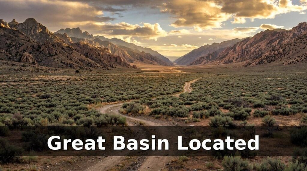
If you have ever looked at a map of the American West and wondered about the huge empty-looking stretch between California and Utah, you were probably looking at the Great Basin located in the western United States. It is one of the largest geographic features in North America, yet most people could not point to it on a map — partly because it is not a single valley, and partly because its borders are drawn by water, not by lines on a map.
So where is the Great Basin located, exactly? The short version is simple: it sits in the western United States, covering nearly all of Nevada and about half of Utah, with smaller pieces reaching into California, Oregon, Idaho and Wyoming. But the full answer is more interesting than that, because the Great Basin located in the western United States is defined by where its rivers go — or rather, where they do not go.
This guide lays it out plainly: the states it covers, the mountain ranges that fence it in, how big it really is, and the famous places sitting inside it, from the Great Salt Lake to Death Valley. There is also a stargazing angle at the end, because the Great Basin located in the western United States happens to hold some of the darkest night skies in the country.
The short answer: The Great Basin located in the western United States, between the Sierra Nevada mountains in California and the Wasatch Range in Utah. It covers almost all of Nevada, the western half of Utah, and parts of California, Oregon, Idaho and Wyoming — about 200,000 square miles in total. Its rivers drain inward, never reaching the sea.
Where Is the Great Basin Located?
The Great Basin located in the western United States occupies the high, dry country of the western United States, roughly centred on the state of Nevada. If you draw a box from the Sierra Nevada on the west to the Wasatch Mountains on the east, and from the Snake River Plain in the north down toward the Mojave Desert in the south, most of what falls inside that box is the Great Basin located in the western United States.
It is not a political region, so you will not find it listed as a state or a county. It is a geographic and hydrographic region — a piece of land defined by its shape and by the way water moves across it. That is why different sources give slightly different sizes for it: the commonly used figure from the National Park Service is about 200,000 square miles, while other references put it closer to 209,000 square miles depending on exactly where the boundary is drawn. Either way, it is an enormous area — roughly the size of France, or about twice the size of the United Kingdom.
The centre of the Great Basin located in the western United States sits around 40°40′N latitude, 117°40′W longitude, which puts it in north-central Nevada, not far from the town of Winnemucca. From there it spreads out in every direction, which is why so many travellers cross it without realising they are inside it. Drive Interstate 80 across northern Nevada, or Interstate 15 through western Utah, and you are travelling through the Great Basin for hours at a time.
Which States Does the Great Basin Cover?
The Great Basin located in the western United States is not contained in one state. It spreads across six US states, plus a small slice of Mexico:
- Nevada — nearly the whole state lies inside the Great Basin. It is the heart of the region, and Nevada is often described as the most mountainous state in the country because of the dozens of ranges packed inside the basin.
- Utah — about the western half of the state, including the Great Salt Lake and the Salt Lake City area on the basin’s eastern edge.
- California — the eastern edge of the state, including Death Valley and the Owens Valley, along the foot of the Sierra Nevada.
- Oregon — the south-eastern corner of the state, a remote stretch of high desert.
- Idaho — a small portion in the south of the state.
- Wyoming — a small portion in the south-west of the state.
- Baja California, Mexico — a small part of the basin’s southern reach extends across the border.
Nevada dominates the picture. If someone asks where the Great Basin located in the western United States is and wants a one-state answer, Nevada is the honest reply — but the region is bigger than any single state, and its eastern half in Utah is just as much a part of it.
What Borders the Great Basin on Each Side?
The Great Basin located in the western United States is fenced in by mountains and deserts on all four sides. These borders matter, because they are the reason the region is so dry and the reason its rivers never reach the ocean.
| Side | Border | What it does |
|---|---|---|
| West | Sierra Nevada (and the Cascade Range) | Blocks moist Pacific air, casting a rain shadow over the basin |
| East | Wasatch Range | Forms the eastern wall, rising above the Salt Lake Valley |
| North | Snake River Plain / Columbia Plateau | Marks the northern edge of the basin |
| South | Mojave Desert | The southern rim, less sharply defined than the other three |
The western border is the most important. The Sierra Nevada is a tall, steep range, and when wet air comes in from the Pacific Ocean it is forced upward, cools, and drops its rain and snow on the western slopes. By the time that air crosses the crest and descends into the Great Basin, it is dry. This rain shadow effect is the main reason the basin is a desert.
The eastern border, the Wasatch Range, works in a similar way on the other side. Between the two ranges sits a landscape of parallel mountain ridges and flat valleys, running roughly north to south like the folds of a concertina. There are more than 150 separate mountain ranges inside the Great Basin, separated by broad, flat valleys — a pattern geologists call basin and range topography.
Why Is It Called a Basin?
The word “basin” usually makes people picture a single bowl-shaped valley. The Great Basin located in the western United States is not one valley at all. It is a collection of hundreds of small basins, all sharing one unusual feature: none of their rivers flow to the sea.
Most rivers in North America eventually reach an ocean. Rivers in the Great Basin located in the western United States do not. They flow inward, downhill into the nearest valley floor, where they end in a salty lake, a marsh, or a dry lake bed called a playa. The water then evaporates or soaks into the ground. Geographers call this internal drainage, and a region with no outlet to the sea is called endorheic.
That single fact is what defines the Great Basin located in the western United States. The Great Basin located in the western United States is the largest area of contiguous endorheic watersheds in North America. The boundary of the Great Basin located in the western United States is, in effect, the line where water stops flowing outward to the Pacific or the Gulf of Mexico and starts flowing inward instead. That line is called the Great Basin Divide.
This is also why the region is full of salt. Over thousands of years, rivers have carried dissolved minerals down from the mountains and left them behind when the water evaporated. The Great Salt Lake in Utah is the most famous result: it is the salty remnant of a much larger ancient lake, Lake Bonneville, which covered a large part of western Utah at the end of the last Ice Age.
The Great Basin vs the Great Basin Desert
People often mix up the Great Basin and the Great Basin Desert, and it is easy to see why — the names are nearly identical and they overlap. But they are not the same thing.
The Great Basin located in the western United States is the big hydrographic region we have been describing: about 200,000 square miles defined by internal drainage. The Great Basin Desert is smaller. It is the desert ecoregion that sits inside the basin, defined by its climate and its plants — mainly sagebrush, shadscale and other cold-desert shrubs. The desert covers roughly the northern and central parts of the basin.
So the desert is inside the basin, but the basin is not all desert in the ecological sense. The southern edge of the Great Basin, around Death Valley and the Mojave transition, is hotter and belongs to a different desert system. And the high mountain ranges inside the basin hold forests, alpine meadows and even glaciers in shaded cirques — not what most people picture when they hear the word “desert”.
If you remember one distinction, make it this one: the Great Basin located in the western United States is a watershed, the Great Basin Desert is a climate zone. The first is about where water goes, the second is about how dry it is.
How Big Is the Great Basin?
The Great Basin located in the western United States is big enough that it is hard to picture without a comparison. Different definitions give slightly different numbers, so here is how it stacks up:
| Comparison | Size |
|---|---|
| Great Basin located in the western United States (National Park Service figure) | About 200,000 square miles |
| Great Basin located in the western United States (hydrographic survey figure) | About 209,000 square miles |
| France | About 213,000 square miles |
| State of California | About 164,000 square miles |
| State of Texas | About 269,000 square miles |
In other words, the Great Basin is larger than California and only a little smaller than France. Driving across it takes the best part of a day: the northern edge to the southern edge runs roughly 800 miles, and the widest point, east to west, is around 500 miles.
It is also worth remembering that this is not empty land in the sense of being featureless. Inside that 200,000 square miles there are more than 150 mountain ranges, dozens of valleys, salt flats, sand dunes, hot springs and ancient lake beds. The emptiness people notice from the highway is mostly a lack of towns, not a lack of landscape.
Famous Places Inside the Great Basin
A surprising number of well-known American places sit inside the Great Basin located in the western United States. If you have visited any of these, you have already been there:
- Great Salt Lake, Utah — the largest saltwater lake in the Western Hemisphere and the salty remnant of ancient Lake Bonneville. Its shoreline sits on the eastern edge of the basin, next to Salt Lake City.
- Death Valley, California — one of the hottest places on Earth. Badwater Basin, at 282 feet below sea level, is the lowest point in North America, and it lies within the southern Great Basin.
- Great Basin National Park, Nevada — the only national park that carries the region’s name. It protects a small but representative slice of the whole basin, including Wheeler Peak, ancient bristlecone pine groves, and the Lehman Caves.
- Wheeler Peak, Nevada — at 13,065 feet, the highest point in Great Basin National Park and one of the tallest peaks in Nevada. Its slopes hold a grove of bristlecone pines, some of which are thousands of years old and among the oldest living trees on Earth.
- Reno and Sparks, Nevada — the largest metropolitan area on the western side of the basin, sitting at the foot of the Sierra Nevada.
- Salt Lake City and the Wasatch Front, Utah — the largest population centre on the eastern side, where the basin meets the Wasatch Range.
- The Bonneville Salt Flats, Utah — a vast, blindingly white salt plain, famous for land-speed racing, and the dried bed of part of ancient Lake Bonneville.
- Pyramid Lake, Nevada — a large desert lake on the Paiute reservation, and one of the few remnants of ancient Lake Lahontan.
Most of these places are a long drive from each other, which is itself a useful way to understand the scale of the region. Great Basin National Park and Great Salt Lake are roughly 250 miles apart — and both are inside the same basin.
What Is the Climate Like in the Great Basin?
The Great Basin located in the western United States has a cold desert climate, which surprises people who associate deserts with heat. Summers are hot and dry, but winters are cold, and snow is common in the valleys and heavy in the mountains.
Daytime summer temperatures in the lower valleys often pass 90°F (32°C), and Death Valley has recorded some of the highest air temperatures ever measured on Earth. Winter nights, on the other hand, can drop well below freezing, and the high valleys of central Nevada regularly see snow from late autumn through early spring.
Rainfall is low almost everywhere in the basin — much of it receives less than 10 inches (250 mm) of precipitation a year, and some of the driest valleys get far less. What rain does fall tends to arrive in two patterns: winter storms coming in from the Pacific, and summer thunderstorms that build over the mountains in the afternoon and can drop a sudden, heavy burst of rain on one valley while the next valley over stays dry.
Elevation makes a big difference. The valley floors sit at roughly 4,000 to 6,000 feet above sea level, while the mountain ranges rise to 10,000 feet and higher. That means you can drive from a hot, dry valley floor to a cool pine forest in less than an hour, just by climbing one of the ranges. Wheeler Peak, for example, holds snow into the summer while the valley below it bakes.
Who Lives There?
For all its size, the Great Basin located in the western United States is one of the least densely populated regions in the United States. Most of its 200,000 square miles is public land — managed as national forest, Bureau of Land Management land, military ranges and wildlife refuges — with small towns scattered along the highways.
The two big population centres sit on opposite edges of the basin: the Reno–Sparks area in the west, and the Wasatch Front (Salt Lake City and its neighbours) in the east. Together they hold the large majority of the basin’s people. Between them lie small towns like Ely and Winnemucca in Nevada, and Delta and Fillmore in Utah, many of them built around mining, ranching or a highway junction.
People have lived in the Great Basin located in the western United States for thousands of years. The region is the homeland of the Shoshone, Paiute and Washoe peoples, whose cultures adapted to a dry landscape where water and food are scattered rather than concentrated. Later came explorers, fur traders, miners drawn by silver and gold, and ranchers who found that the wide valleys suited cattle and sheep. The Pony Express and the first transcontinental telegraph crossed the basin, and the first transcontinental railroad followed — all of them choosing routes through the valleys between the ranges.
Today the economy of the basin is a mix of mining, ranching, military activity, tourism and the cities on its edges. Much of the interior remains quiet, which is exactly what draws the people who do visit: dark skies, empty roads and a landscape that has not changed much in a long time.
Why Stargazers Love the Great Basin
Here is the part that matters most for anyone who loves the night sky. The Great Basin located in the western United States has some of the darkest skies left in the United States, and astronomers and stargazers have known it for years.
The reasons are the same ones that make the region a desert: very little rain, very little cloud, and almost no city lights across most of its area. Add high elevation — the thin, dry air at 5,000 feet and above is steadier and clearer than the air at sea level — and you get observing conditions that are hard to beat anywhere in the lower 48 states.
Great Basin National Park was designated an International Dark Sky Park in 2016, and on a clear, moonless night there the Milky Way is bright enough to cast a faint shadow. The park runs astronomy programmes in the summer, and its remote location in eastern Nevada means the nearest significant light pollution is hours away by car.
That darkness is also why the basin keeps appearing in astronomy news. Its clear skies and dry air make it a natural place for telescopes and for anyone who wants to see the sky the way it looked before electric light. If you ever plan a stargazing trip, the Great Basin located in the western United States is one of the best places in the country to do it — just bring warm clothes, because those clear skies also mean cold nights.
How to Find the Great Basin on a Map
If you want to locate the Great Basin located in the western United States on a map yourself, here is the simplest way to do it:
- Find Nevada first. The Great Basin covers almost the whole state, so Nevada is your anchor.
- Look for the Sierra Nevada running down the eastern edge of California. Everything east of that range, for hundreds of miles, is basin country.
- Look for the Wasatch Range running north to south through Utah, just east of Salt Lake City. That is the eastern wall.
- Trace the Snake River Plain across southern Idaho. That marks the northern edge.
- Look for the Great Salt Lake in northern Utah and Death Valley in south-eastern California. Both sit inside the basin, near its eastern and southern edges, and they make good reference points.
- Check the rivers. If a river on the map ends in a lake or a dry lake bed instead of flowing to the sea, you are almost certainly looking at the Great Basin.
One common mistake is to look for a single valley with the name “Great Basin” written across it. You will not find one, because there is no single valley. The name covers the whole system of ranges and valleys together, and on many maps it is written across the middle of Nevada in large letters, spanning the entire state.
Frequently Asked Questions
Where is the Great Basin located?
The Great Basin located in the western United States, between the Sierra Nevada in California and the Wasatch Range in Utah. It covers nearly all of Nevada, the western half of Utah, and parts of California, Oregon, Idaho and Wyoming.
Is the Great Basin a desert?
Mostly, yes — it is a cold desert region, and the Great Basin Desert sits inside it. But the Great Basin located in the western United States itself is defined by its drainage, not its climate, and it also contains forests, alpine areas and salt lakes. Not every part of it is desert in the ecological sense.
What states are in the Great Basin?
Nevada, Utah, California, Oregon, Idaho and Wyoming all contain parts of the Great Basin located in the western United States. Nevada holds the largest share — nearly the whole state — followed by Utah, which holds about its western half.
How big is the Great Basin?
About 200,000 square miles, according to the National Park Service, with some hydrographic surveys putting it at about 209,000 square miles. That makes it larger than California and roughly the size of France.
Why do the Great Basin’s rivers not reach the ocean?
The basin is ringed by mountains — the Sierra Nevada to the west and the Wasatch Range to the east — and its valley floors have no outlet. Rivers flow inward and end in salty lakes or dry lake beds, where the water evaporates. This is called internal drainage, and the Great Basin located in the western United States is the largest endorheic region in North America.
What is the difference between the Great Basin and the Great Basin Desert?
The Great Basin located in the western United States is the larger hydrographic region, defined by internal drainage. The Great Basin Desert is the smaller desert ecoregion inside it, defined by climate and vegetation. The desert sits inside the basin, but the basin is not all desert.
Can you visit the Great Basin?
Yes. Great Basin National Park in eastern Nevada is the best starting point, with Wheeler Peak, bristlecone pines, Lehman Caves and some of the darkest night skies in the country. The Great Salt Lake, the Bonneville Salt Flats and Death Valley are also inside the basin and easy to reach by road.
Final Thoughts
The Great Basin located in the western United States is one of those places that is easy to miss and hard to forget once you understand it. It is not a single valley but a whole system of mountains and valleys, defined by a simple and unusual fact: its rivers never reach the sea. It covers most of Nevada and half of Utah, it holds the lowest point in North America and some of the oldest trees on Earth, and it offers night skies dark enough to see the Milky Way in detail.
If you came here asking where the Great Basin located in the western United States is, the answer to carry away is a picture, not a postcode: a vast stretch of high desert country between two great mountain ranges, full of ranges and valleys of its own, with Salt Lake City on one side, Reno on the other, and a lot of open, star-filled sky in between.
Read Also: Meteoroid Meteorit: Meaning, Types and How They Reach Earth
1 Comment