
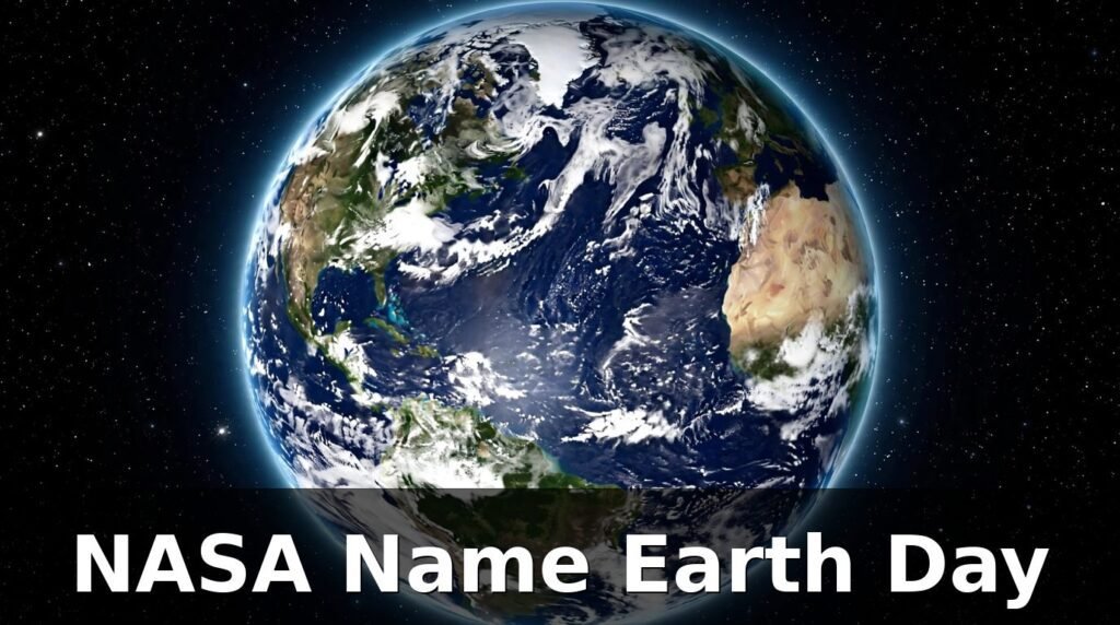
Type your name into a NASA tool on Earth Day and the planet spells it back to you. Not with a font or a filter, but with real shapes photographed from orbit: a river bending into the curve of an S, a sandbar stretched into a straight I, a mountain ridge forming the peak of an A. That is the simple, clever idea behind the phrase “nasa name earth day,” and it is why the search has become a small Earth Day tradition of its own.
Every year on April 22, NASA marks Earth Day with images of our home planet taken from space. In recent years the agency has gone one step further and made the celebration personal. Its “Your Name in Landsat” interactive takes the letters of your name and matches each one to a real piece of Earth’s surface captured by Landsat satellites. The result is your name written by the planet itself.
This article explains what the NASA name Earth Day idea is, how the tool works, where the letters come from, and what Landsat has been doing for our planet since 1972. You will also learn how to try it yourself, what NASA’s Earth Day posters show, and why the agency spends so much time looking back at Earth instead of only looking out at the stars.
The short answer: “NASA name Earth Day” refers to NASA’s “Your Name in Landsat” feature, shared for Earth Day. You type in your name, and the tool spells it using real satellite images of Earth’s rivers, coastlines, deserts, and mountains, each letter matched to a natural shape photographed by Landsat satellites. Earth Day falls on April 22 every year, and Landsat is a joint NASA and U.S. Geological Survey mission that has been imaging Earth’s land since 1972.
More Information: What Is the Milky Way Galaxy? A Simple Explanation
What Does “NASA Name Earth Day” Mean?
If you searched for “nasa name earth day,” you were probably looking for one of two things: a way to see your name written with NASA satellite images, or an explanation of how NASA celebrates Earth Day. The good news is that both lead to the same place.
The phrase is not the name of an official NASA program. It is the way people search for NASA’s Earth Day feature, “Your Name in Landsat.” The interactive first drew wide attention when NASA turned it into an Earth Day poster in 2025, and it has been shared again every April since. For Earth Day 2025, NASA celebrated April 22 with imagery from the Landsat mission, and the poster was built around the same idea: the planet spelling out a name, letter by letter, in satellite photographs.
Why People Search for It Every April
Searches spike each spring for a simple reason. Earth Day gives people a reason to look at the planet with fresh eyes, and a name spelled in rivers and ridgelines is far more memorable than another stock photo of a globe. Teachers share it in classrooms, parents try it with their children, and social media fills up with names written in desert dunes and winding coastlines.
There is also a curiosity factor. Most of us have seen satellite photos of Earth before, but we rarely think of them as an alphabet. The tool changes that. Once you see a river shaped like a C or a road like a T, you start looking at the landscape differently, and that is exactly the point NASA is making.
Is It a Real NASA Tool?
Yes. “Your Name in Landsat” is a real interactive from NASA’s Landsat team. It draws on the Landsat image archive, a collection built up over more than fifty years of Earth observation. The letters come from real satellite images sourced from NASA Earth Observatory, NASA Worldview, USGS EarthExplorer, and ESA Sentinel Hub. Nothing is drawn or invented. Each letter is a genuine piece of the planet’s surface, photographed from hundreds of kilometres above it.
How Does Your Name in Landsat Work?
The idea is simple, even though the work behind it is not. When you type a name into the tool, it looks through the Landsat archive for a satellite image shaped like each letter you entered, then lines the images up side by side to spell your name.
Step by Step: From Your Keyboard to Orbit
The process follows a short chain of steps:
- You type your name into the interactive on NASA’s website.
- The tool checks its library of letter-shaped images for each character.
- It picks one satellite image per letter, choosing natural features that match the shape.
- It places the images in order, so your name appears as a row of real landscapes.
- You can save or share the result, often as a poster-style image.
Some letters are easy to find in nature. Rivers make natural curves, coastlines make long sweeping lines, and sandbars make clean straight edges. Others are harder. Letters with tight loops or sharp angles need just the right bend of a river or the right corner of a field. That is why the library behind the tool matters so much: with decades of images to choose from, the team could find a good match for every letter of the alphabet.
Who Built It?
The interactive was developed by members of the Landsat Project Science Support Team, including Ross Walter, Allison Nussbaum, and Ginger Butcher. For Earth Day 2025, Heather Hanson, Deputy Manager for the Science Support Office in NASA’s Science Mission Directorate, had the idea of turning the interactive into a poster, so the name-spelling concept could be shared as a single image as well as an online tool.
The response was strong. As of May 1, 2025, the interactive had passed one million page views, a sign of how far a simple, playful idea can travel when it is built on real science.
Where Do the Letters Come From?
Every letter in the tool is a piece of real geography. The images come from Landsat satellites, which photograph Earth’s land surface in detail, including wavelengths of light our eyes cannot see. That extra information is what makes the images so rich, and it is also what makes them useful for science.
Rivers, Coastlines, and Mountain Ridges
Rivers are the best letter-makers in the collection. A meandering river can form almost any curve, and from space its bends look like handwriting. Coastlines work the same way, with bays and headlands forming smooth arcs. Mountain ridges give the sharper letters their angles, while sandbars, roads, and field boundaries provide the straight lines.
Deserts contribute too. Wind-shaped dunes make soft, flowing shapes, and dry lake beds leave pale outlines against darker ground. Even city patterns show up: a straight highway can form an I, and a roundabout or a reservoir can form an O.
Why Landsat Images Look the Way They Do
Landsat images often look more colourful than an ordinary photograph. That is because the satellites record light beyond the visible range, including infrared. Scientists use those extra bands to study plant health, water, and land cover. For the name tool, the same data gives each letter its striking colour, from deep green forests to rust-red deserts and bright blue water.
What Is Landsat, and Why Does NASA Use It for Earth Day?
Landsat is the longest-running Earth-observation program of its kind. It is jointly managed by NASA and the U.S. Geological Survey (USGS), and it has been photographing Earth’s land surface without a break since 1972. That unbroken record is what makes it so valuable, both for science and for an Earth Day celebration.
The Longest Continuous Record of Earth’s Land
The first Landsat satellite launched on July 23, 1972. It was originally called the Earth Resources Technology Satellite, or ERTS, and it was renamed Landsat a few years later. Since that first launch, successive Landsat satellites have kept the record going, building an archive of millions of images of Earth’s land surface.
Today the work is carried by Landsat 8, launched in 2013, and Landsat 9, launched on September 27, 2021. Both are active, and together they image the whole planet on a regular cycle, so scientists can compare how the same place looks year after year.
What Landsat Actually Measures
Landsat satellites collect data-rich images of land cover at a resolution fine enough to detect individual farm fields. They track forests, farmland, cities, coastlines, glaciers, and water. Because the record stretches back more than fifty years, researchers can measure change over time: a forest shrinking, a city spreading, a lake drying up, or a glacier retreating.
That long view is the reason Landsat sits at the centre of NASA’s Earth Day celebrations. Earth Day is about noticing the planet and caring for it, and few tools show the planet changing as clearly as a fifty-year photo album taken from space.
Earth Day and Landsat: A Short Shared History
Earth Day and Landsat grew up together. The first Earth Day was held on April 22, 1970. Less than two years later, the first Landsat satellite was in orbit. The table below puts the two stories side by side.
| Year | What Happened |
|---|---|
| 1970 | The first Earth Day is held on April 22 |
| 1972 | The first Landsat satellite launches on July 23 |
| 2013 | Landsat 8 launches and joins the mission |
| 2020 | NASA marks the 50th Earth Day, with Landsat featured prominently |
| 2021 | Landsat 9 launches on September 27 |
| 2022 | The Landsat team attends the Earth Day event at Union Station in Washington, DC, from April 22 to 24, and the Google Doodle for Earth Day features Landsat time-lapse data |
| 2025 | NASA celebrates Earth Day with the “Your Name in Landsat” poster |
The connection is more than a coincidence of dates. Landsat was built in the same spirit as Earth Day: the belief that understanding the planet is the first step to looking after it. The scientists who prepared the first satellite were working on it while the first Earth Day was still fresh in people’s minds, and the mission has been part of the celebration ever since.
What Can You See in Your Name?
Trying the tool is a small geography lesson in itself. Each letter shows you a real place, and many of the images reward a closer look. Here are some of the features you are most likely to meet.
Rivers That Write in Cursive
A winding river is the closest thing nature has to handwriting. From orbit, a river’s bends look like loops and curves, which is why so many of the vowels and round letters in the tool come from rivers. The same bends that spell your name also tell a story about the land: where the ground is flat, rivers wander; where it is steep, they run straight.
Coastlines, Dunes, and Field Patterns
Coastlines give the tool its long, smooth strokes. A bay curving into the land can form a C, and a narrow peninsula can form a thin line. In deserts, wind-blown dunes create soft waves of sand that read as curves from above. And in farming country, the patchwork of fields adds straight edges and right angles, the shapes that rivers rarely provide.
A New Way to Look at Maps
Once you have seen your name spelled in landscapes, ordinary maps start to look different. You notice the shape of a river you had never paid attention to, or the curve of a coastline on a holiday photo. That shift in attention is the quiet success of the tool. It turns a satellite archive into something personal, and a personal connection is often what turns curiosity into care.
More Information: Directions to Workplace: Easy Ways to Find Your Office
How to Try Your Name in Landsat Yourself
You do not need special software or an account. The interactive runs in a web browser, and the whole thing takes less than a minute.
- Go to NASA’s Landsat pages and find the “Your Name in Landsat” interactive.
- Type your first name, or any short word, into the box.
- Wait a moment while the tool matches each letter to a satellite image.
- Look at the result and check which landscapes made your letters.
- Save or share the image if you want to keep it, or try another name.
A few tips make the result better. Short names work best, because each letter gets a clear, readable image. Long names can still work, but the letters get smaller and harder to read. If a letter looks unclear, try a different spelling or a nickname. And if you are using it with children, let them guess which landscape made each letter before you tell them: a river, a road, a coastline, or a mountain ridge.
What NASA’s Earth Day Posters Show
NASA has made an Earth Day poster almost every year, and each one is built from real satellite imagery. The posters are free to download, and they make a good companion to the name tool, because they show the same idea on a bigger canvas: Earth as a work of art that is also a scientific record.
The 2024 poster was ocean-themed and composited from real satellite imagery taken by NASA’s Terra, Aqua, and Landsat missions. It highlighted cloud streets over the Black Sea and a bloom of phytoplankton in the Argentine Sea, two ocean features that look striking from space and matter deeply to the health of the seas.
The 2025 poster used Landsat imagery to spell out a name, bringing the interactive into poster form. Earlier, for the 50th Earth Day in 2020, Landsat featured prominently in NASA’s celebrations, with images showing how the mission helps the U.S. Department of Agriculture track what is growing on America’s farmland.
Why Posters Matter
A poster might seem like a small thing next to a satellite, but it does a job the data alone cannot do. It puts a beautiful image of Earth in a classroom, an office, or a living room, where people see it every day. And every time someone asks what the image shows, there is a chance to talk about the science behind it: the satellites, the data, and the changing planet they record.
Why NASA Studies Earth From Space
It surprises some people that a space agency spends so much time looking at Earth. But NASA’s job has always included our own planet. The agency’s Earth Science Division operates more than twenty satellites, with more instruments riding on the International Space Station, on aircraft, and on the ground.
The Fleet Watching Our Planet
The table below lists some of the best-known missions in NASA’s Earth-observing fleet and what each one watches.
| Mission | What It Watches |
|---|---|
| Landsat 8 and 9 | Land cover, forests, farms, and cities |
| Terra | Land, oceans, atmosphere, and energy |
| Aqua | Water cycle, oceans, and clouds |
| SWOT | Ocean height and surface water |
| PACE | Ocean life, aerosols, and clouds |
| TEMPO | Air quality over North America |
| Sentinel-6 Michael Freilich | Sea level |
| DSCOVR | The sunlit face of Earth from deep space |
Each mission measures something different, and together they build a picture of the planet as a system. Warming in one place affects rainfall somewhere else. A dry year in one region changes harvests in another. Satellites are the only way to watch all of it at once.
From Weather to Climate
Short-term observations feed weather forecasts, while the long record feeds climate science. Landsat’s fifty-year archive is especially important here. A single image shows what a place looks like today; a stack of images across decades shows how it is changing. That is how scientists track deforestation, urban growth, glacier loss, and the spread of farmland, and how they check whether efforts to protect a place are working.
What Landsat Data Is Actually Used For
The name tool is fun, but the same images do serious work every day. Here are some of the ways Landsat data is used around the world:
- Farmers and agriculture agencies track what is growing on farmland and how crops are doing through the season.
- Forest managers watch for logging, wildfire damage, and regrowth.
- City planners measure how towns and cities spread into surrounding land.
- Water managers track lakes, reservoirs, and rivers, including how they shrink in dry years.
- Scientists study glaciers and sea ice, building a record of change at both poles that now stretches back decades.
- Disaster teams use fresh images to map floods and wildfire damage and to plan relief.
The key point is that the data is free and open. Anyone can download Landsat images, from researchers and governments to teachers, farmers, and students. That open access is part of why the name tool exists at all: the archive belongs to everyone, so NASA can invite everyone to play with it.
Frequently Asked Questions
What is “Your Name in Landsat”?
It is a NASA interactive that spells your name using real satellite images from the Landsat archive. Each letter is matched to a natural feature on Earth’s surface, such as a river, coastline, or mountain ridge, photographed by a Landsat satellite.
When is Earth Day?
Earth Day is held every year on April 22. The first Earth Day was in 1970, and the day is now marked around the world with events focused on the environment and the planet.
Is the NASA name tool free to use?
Yes. The interactive is free, runs in a web browser, and does not need an account. NASA also offers its Earth Day posters as free downloads.
What is Landsat?
Landsat is a joint mission of NASA and the U.S. Geological Survey that has been imaging Earth’s land surface since 1972. Landsat 8 and Landsat 9 are the satellites currently in orbit, continuing the longest continuous space-based record of Earth’s land.
Are the letters in the tool real places?
Yes. Every letter comes from a genuine satellite image of Earth’s surface. The images are sourced from NASA Earth Observatory, NASA Worldview, USGS EarthExplorer, and ESA Sentinel Hub, and each one shows a real river, coastline, desert, or other landscape feature.
Why does NASA celebrate Earth Day?
NASA studies Earth as well as space. Earth Day is a natural moment to share what its satellites see: a changing planet, watched closely for more than fifty years. The celebration is a way to invite the public into that work.
Can I use the name image for a classroom or at home?
Yes. The tool is designed to be shared, and teachers often use it in lessons about geography, maps, and Earth science. It works well as a starting point for talking about rivers, coastlines, and how satellites see the planet.
Conclusion
The phrase “nasa name earth day” points to a small idea with a big message. Type in your name, and NASA shows it back to you written in rivers, coastlines, and mountain ridges, photographed from orbit by Landsat satellites. It is a playful way to mark Earth Day, but it rests on something serious: more than fifty years of watching our planet from space, carried out by NASA and the U.S. Geological Survey.
Earth Day comes around every April 22, and the name tool will be there waiting each time. Try your own name, look closely at the landscapes that spell it, and then look at the wider picture the images belong to. A planet that can spell your name is a planet worth understanding, and worth looking after.
Read Also: When Is the Next Meteor Shower? Peak Dates for 2026
