
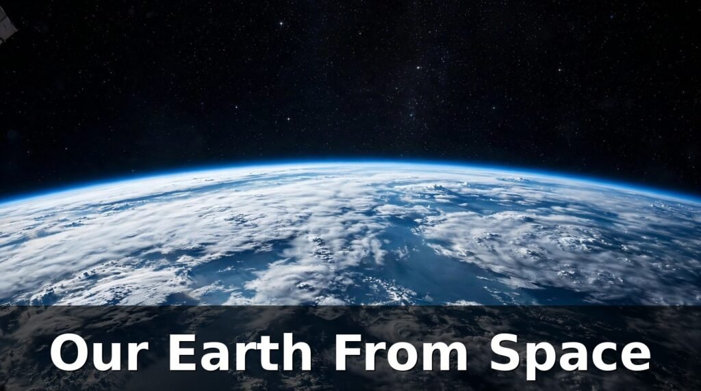
Most of us will never leave the ground, yet almost everyone has seen our Earth from space. It is the blue marble on a classroom wall, the glowing ball in a weather forecast, the pale crescent in a photograph taken from the Moon. Those images feel familiar, but they hide a surprise. The planet we live on looks nothing like the flat maps we grew up with, and the people who have actually seen it with their own eyes almost always say the same thing: it changed how they thought about home.
From space, Earth is not a collection of countries. It is one bright, round world floating in blackness, wrapped in a thin blue shell of air. There are no lines drawn across it, no labels, no borders you can point to. There are oceans that stretch further than the eye can follow, clouds that drift like smoke, and deserts and forests that look painted on. Once you have seen that view, even in a photograph, it is hard to go back to thinking of Earth as just the ground under your feet.
This article looks at what our Earth from space really looks like, how the famous photographs were taken, what astronauts see from the International Space Station, and why that view has such a powerful effect on the people who experience it.
The short answer: From space, Earth looks like a bright blue sphere covered mostly by ocean, with swirling white clouds, brown and green land, white ice at the poles, and a thin blue line of atmosphere around its edge. Astronauts in low Earth orbit see only part of it at a time, while cameras much farther away can capture the whole disc at once.
More Information: Perseverance: NASA’s Mars Rover Mission Explained Simply
What Does Our Earth From Space Actually Look Like?
If you could step outside a spacecraft and look back, the first thing you would notice is the colour. Earth is overwhelmingly blue. About seven tenths of its surface is covered by ocean, so blue dominates every full view of the planet. The second colour you would notice is white: clouds, storms, and the ice caps. Land comes third, in patches of green, brown, and tan.
The second thing you would notice is how bright Earth is. Sunlight bounces off the oceans, the clouds, and the ice, so the planet shines against the black sky. The contrast is so strong that photographs of Earth often make the background look completely empty, even though the stars are there. The planet simply outshines them.
The third thing is the curve. From the ground, Earth feels flat because we are so small compared to it. From orbit, the curve is obvious. The horizon bends away in every direction, and the atmosphere appears as a thin glowing rim, like the edge of a soap bubble. That thin rim is the air we breathe, and from space it looks impossibly fragile.
Why the View Changes With Distance
How much of Earth you can see depends entirely on how far away you are. That is why different photographs of our planet look so different from one another.
- From an aeroplane window, around 10 kilometres up, you see towns, rivers, fields, and coastlines, but no curve and no sense of the whole planet.
- From the International Space Station, around 400 kilometres up, you see the curve clearly, but only a patch of the planet at a time.
- From the Moon, around 384,400 kilometres away, you can see the whole disc of Earth at once, small enough to cover with your thumb.
- From the DSCOVR spacecraft, around 1.5 million kilometres away, Earth is a full, sunlit ball, and even the Moon looks small beside it.
Distance does not just change the size of Earth in the frame. It changes what the picture can tell you. Close views show weather and landscapes. Distant views show the planet as a single system, with oceans, clouds, and land working together.
Why Does Earth Look Blue From Space?
Earth looks blue for two reasons, and both are easy to understand once you know them. The first is the oceans. Water absorbs the red end of sunlight and reflects the blue end, so large stretches of open ocean look deep blue from above. Because oceans cover most of the planet, blue becomes the dominant colour of the whole disc.
The second reason is the atmosphere. Air molecules scatter blue sunlight more than other colours, which is the same reason the sky looks blue from the ground. From space, that scattering adds a blue glow to the edges of the planet, especially where the atmosphere is seen side-on at the limb.
What About the Green, Brown, and White?
Not everything on Earth is blue, and the other colours tell their own story.
- Green areas are usually forests, grasslands, and farmland, where plants cover the ground.
- Brown and tan areas are often deserts, dry plains, and mountain ranges with little plant cover.
- White areas are clouds, snow, and sea ice. Clouds move and change shape from hour to hour, so no two photographs of Earth ever show exactly the same pattern.
- Dark areas at night are not empty. City lights show where people live, and they cluster along coasts and rivers in a pattern that follows population, not politics.
Seen together, those colours make Earth look alive in a way no other planet in our solar system does. Mars is red and dusty. Venus is wrapped in thick yellow cloud. The Moon is grey and still. Earth is blue, white, green, and brown all at once, and that mix is a sign of liquid water, weather, and life.
What Is the Blue Marble Photograph?
The most famous photograph of our Earth from space is called the Blue Marble. It was taken by the crew of Apollo 17 in December 1972, on their way to the Moon. It shows the whole Earth, fully lit by the Sun, with Africa in the centre, the Atlantic Ocean on one side, and Antarctica at the bottom.
The Blue Marble matters for a simple reason: it was the first clear, full-disc photograph of Earth taken by people, rather than by a robotic camera. Earlier pictures had been taken, but this one was sharp, colourful, and centred on the whole planet. It quickly became one of the most reproduced images in history, appearing on posters, book covers, and television screens around the world.
Why the Blue Marble Still Matters Today
More than fifty years later, the Blue Marble still shapes how people picture Earth. There are a few reasons for that.
First, it is honest. It is not an artist’s impression or a computer model. It is a photograph of the real planet, taken by a camera held by a person looking back at home.
Second, it is complete. You can see the whole Earth at once, which is something no person standing on the ground can ever do. That completeness is what makes the image feel so powerful.
Third, it arrived at the right time. By the early 1970s, people were becoming more aware of pollution, deforestation, and the limits of natural resources. A photograph that showed Earth as a small, bright, finite world gave that awareness a picture to hold on to.
Modern satellites now take sharper full-disc images every day, but none of them has replaced the Blue Marble in the public imagination. It remains the reference point against which every later picture of Earth is measured.
What Is Earthrise, and Why Did It Shock People?
Four years before the Blue Marble, another photograph changed how humanity saw itself. It is called Earthrise, and it was taken by the crew of Apollo 8 in December 1968, the first crewed mission to orbit the Moon.
The astronauts had gone to the Moon to photograph its surface. As their spacecraft came around the far side, Earth rose above the grey, cratered lunar horizon. It was small, blue, white, and bright against a black sky, hanging above a dead, airless landscape. The crew were so struck by the sight that they scrambled for a camera and took the photograph that became Earthrise.
Why Earthrise Felt So Different
Earthrise was shocking because of the contrast. The Moon in the foreground looks lifeless: grey rock, sharp shadows, no air, no water, no colour. Earth above it looks like the opposite in every way: blue, cloudy, glowing, and alive. The photograph made the difference between the two worlds visible in a single frame.
The picture also changed the way many people thought about space exploration. The mission had been planned to study the Moon, but the image everyone remembered was of Earth. It reminded people that the most interesting thing the astronauts found on their journey was the planet they had left behind.
If the Blue Marble is the portrait of Earth, Earthrise is the reminder of how rare that portrait is. In the photograph, Earth is not large or dominant. It is a small, bright world in a vast darkness, and that smallness is exactly what makes it feel precious.
What Do Astronauts See From the International Space Station?
The International Space Station, or ISS, orbits Earth at an altitude of around 400 kilometres, completing one orbit in about 90 minutes. That means astronauts on board see around 16 sunrises and 16 sunsets every day. They do not see the whole Earth at once, as the Apollo crews did. Instead, they see a huge, curved landscape rolling past below them.
From the ISS, Earth fills much of the view. Coastlines, mountain ranges, rivers, and deserts pass by in a steady stream. Clouds cast shadows on the ground. Storms look like great white spirals. At night, cities glow in orange and yellow, and lightning flashes inside thunderclouds like a camera going off in the dark.
The Cupola: A Window on the World
The best-known viewing spot on the ISS is the Cupola, a dome-shaped module with seven windows. Six windows run around the sides and one sits on top, giving astronauts a wide view of Earth below and space beyond. It is often called a window on the world, and it is where many astronauts go simply to look at home.
Astronauts have described the Cupola view as hard to put into words. The planet is close enough to show detail — you can pick out islands, lakes, and coastlines — but far enough away that whole countries pass in minutes. The speed is part of the experience. The station moves at around 28,000 kilometres per hour, so the landscape below never stays still for long.
Photographs taken from the Cupola and other ISS windows now number in the millions. NASA notes that crew members have taken more than 3.5 million photographs of Earth from the station. Many of those images are used by scientists to track changes in coastlines, forests, glaciers, and cities over time. Others are simply shared because they are beautiful.
Day, Night, and the Thin Blue Line
One of the most striking sights from the ISS is the edge of the atmosphere at sunrise and sunset. As the station crosses from day into night, the Sun sets behind the curve of Earth, and the atmosphere glows in bands of orange, pink, and deep blue. The layer of air looks paper-thin against the blackness of space.
That thinness surprises many first-time viewers. From the ground, the sky feels deep and endless. From orbit, it is a narrow shell, only a tiny fraction of Earth’s size. Astronauts often say that seeing how thin the atmosphere is makes them think differently about air pollution and climate, because the air we depend on looks so easy to damage from up there.
How Does DSCOVR Show Us the Whole Earth Every Day?
Not every view of Earth comes from astronauts. Some of the most useful full-disc images today come from DSCOVR, the Deep Space Climate Observatory, a spacecraft that sits at a point called L1, about 1.5 million kilometres from Earth in the direction of the Sun.
DSCOVR carries a camera called EPIC, the Earth Polychromatic Imaging Camera. EPIC takes pictures of the entire sunlit face of Earth, combining images taken in different wavelengths of light to produce a colour portrait. Because DSCOVR sits between Earth and the Sun, it always sees the day side of the planet, fully lit.
Why the DSCOVR View Is Useful
The DSCOVR view is different from the astronaut view in an important way. Astronauts see detail and drama. DSCOVR sees the whole system at once, day after day, in the same way.
That consistency is what makes it valuable for science. By comparing images taken on different days, researchers can track how clouds move, how vegetation changes with the seasons, and how dust and smoke travel across oceans. The images also show the Moon passing in front of Earth from time to time, a reminder of the scale of the Earth-Moon system.
For the rest of us, DSCOVR images are a daily reminder of something simple: Earth is always there, turning in sunlight, whether or not anyone is looking at it. The camera does not need an astronaut to press the shutter. It watches the planet steadily, and the pictures it sends back are available for anyone to see.
Why Are There No Stars in Photos of Earth From Space?
One of the most common questions about photographs of our Earth from space is also one of the most understandable: if space is full of stars, why can’t we see them in the pictures?
The answer is exposure. Earth is bright. Sunlight reflects off its clouds, oceans, and ice, so the planet is far brighter than the stars behind it. A camera set to capture Earth correctly uses a very short exposure, and in that short time the faint light of the stars does not register.
The Same Effect Happens on Earth
You can see the same effect without leaving the ground. Take a photograph of a brightly lit building at night, and the stars above it will usually vanish from the picture, even though you can see them with your eyes. Your eyes adjust constantly, switching between bright and dark areas. A camera cannot do that in a single shot.
Astronauts can see stars when they look away from Earth and let their eyes adjust to the darkness. But a photograph that shows Earth properly exposed will almost always show a black sky. That is not a sign that the photograph is fake. It is a sign that the camera was set for the bright subject in front of it, not the faint stars behind it.
What Is the Overview Effect?
Many astronauts report that seeing Earth from space changes them in a lasting way. Researchers and writers call this the overview effect. It is not a medical term or a single feeling. It is a name for a cluster of reactions that astronauts describe again and again: awe, humility, a sense of connection, and a new awareness of how fragile Earth is.
The pattern is consistent enough that it is worth taking seriously. Astronauts who expected to feel excitement or pride often say they felt something quieter instead. They talk about seeing no borders, about realising that the air and water we share do not respect national boundaries, and about feeling protective of a planet that looked both beautiful and vulnerable.
What Causes It?
No one can say exactly what causes the overview effect, because it is a personal experience, not a measurement. But a few factors come up repeatedly in astronaut accounts.
- Scale: Earth looks large enough to hold everything you know, yet small enough to fit in a window.
- Unity: continents, oceans, and weather appear as one connected system, not as separate places.
- Fragility: the atmosphere looks thin, and the planet looks alone in a vast emptiness.
- Distance: home is suddenly a place you can see whole, rather than a place you stand inside.
Not every astronaut describes the experience in the same words, and some are more moved by it than others. But the fact that so many of them reach for similar language — fragile, beautiful, one world — suggests the view itself does something that words and photographs alone cannot fully capture.
More Information: PlusStories.com: What It Is, Features and Is It Legit?
What Can You Actually See From Space, and What Can’t You See?
People often ask whether astronauts can see famous landmarks or human-made structures from orbit. The honest answer is: some, but not in the way you might expect.
From the ISS, astronauts can pick out large natural features easily: coastlines, great rivers, mountain ranges, deserts, large lakes, and island chains. Cities are visible too, especially at night, when their lights form glowing clusters. Large airports, reservoirs, and agricultural patterns can also stand out, because they create sharp shapes against the natural landscape.
What astronauts generally cannot do is pick out small, individual structures with the naked eye. A single house, a car, or a person is far too small to see from 400 kilometres up. Even large buildings are hard to spot unless they cast a long shadow or sit in open ground with nothing around them.
A Simple Comparison
| Feature | Visible from the ISS? | Why |
|---|---|---|
| Coastlines and islands | Yes, clearly | Large shapes and strong colour contrast with the ocean |
| The Great Wall of China | Not with the naked eye | Too narrow, and its colour blends with the landscape |
| City lights at night | Yes, clearly | Bright clusters against dark land |
| Individual houses or cars | No | Far too small at 400 kilometres distance |
| Clouds and storms | Yes, clearly | Large, bright, and constantly moving |
| Country borders | No | Borders are lines on maps, not features on the ground |
The table makes a useful point: space gives you the big picture, not the small detail. That is both its strength and its limit. You gain a sense of the whole planet, and you lose the close-up view of daily life.
How Can You See Earth From Space Yourself?
You do not need to become an astronaut to see our Earth from space. There are several ways to experience the view, and they range from free to ambitious.
The simplest is to look at the daily images from DSCOVR and the photographs taken by ISS crews, many of which are shared publicly by space agencies. These are real photographs of the real planet, updated regularly, and they give you the full-disc and close-up views without leaving your desk.
A second option is to watch live video from the ISS. Space agencies stream views from cameras mounted on the station, showing Earth rolling past below. The picture is not always live — the feed cuts out at times — but when it is running, it is the closest most of us will come to floating above the planet.
Seeing the ISS From the Ground
A third option is to look up and see the station itself. The ISS is visible to the naked eye as a bright, steady light moving across the sky, usually just after sunset or just before sunrise. It does not twinkle like a star, and it moves much faster than an aeroplane appears to move.
- Check a pass predictor such as NASA’s Spot the Station tool for times over your town.
- Go outside a few minutes early and look in the direction it gives you.
- Watch for a bright point of light gliding smoothly across the sky for several minutes.
- Remember that you are looking at a spacecraft carrying people, 400 kilometres above you, looking back down at Earth.
There is something quietly remarkable about that. You are standing on the planet, looking up at people who are looking down at the planet. Both views are real, and neither one tells the whole story on its own.
How Do Photographs of Earth Help Science?
Photographs of Earth from space are not just beautiful. They are working tools. Scientists use them to study the planet in ways that would be difficult or impossible from the ground.
Weather forecasting is one clear example. Satellite images show storms forming over oceans days before they reach land, giving forecasters time to track them and warn people. Cloud patterns, hurricane spirals, and dust storms are all easier to understand when you can see them whole.
Environmental monitoring is another. By comparing photographs taken years apart, researchers can see forests shrinking or regrowing, glaciers retreating, lakes drying up, and cities spreading outward. A single photograph shows a moment. A series of photographs shows change.
What Satellites Measure That Cameras Cannot
Ordinary photographs show what Earth looks like. Scientific instruments on satellites measure things photographs cannot show directly, such as temperature, vegetation health, ocean height, and air pollution. Those measurements are often turned into maps and images, so they are easier to read, but the underlying data comes from instruments, not from a camera shutter.
The two kinds of information work together. A photograph tells you what a place looks like. A measurement tells you what is happening there. Together, they give scientists a fuller picture of a planet that is always changing, often in ways too slow or too large to notice from the ground.
Frequently Asked Questions About Our Earth From Space
What colour is Earth from space?
Earth looks mostly blue from space, because oceans cover most of its surface and reflect blue sunlight. White clouds and ice, green vegetation, and brown deserts add the other colours you see in full-disc photographs.
Can astronauts see the whole Earth from the ISS?
No. From the ISS, around 400 kilometres up, astronauts see a large curved patch of Earth, but not the whole planet at once. To see the full disc, you need to be much farther away, such as on the way to the Moon or at the DSCOVR spacecraft, 1.5 million kilometres away.
Why does Earth look like a blue marble?
The nickname comes from the Apollo 17 photograph known as the Blue Marble, taken in December 1972. In the picture, Earth looks like a small blue marble floating in black space, with swirling white clouds and brown and green land visible through them.
Is the overview effect real?
Astronauts frequently describe a strong emotional reaction to seeing Earth from space, including awe and a sense of unity and fragility. It is a widely reported personal experience, not a formal scientific measurement, and different astronauts describe it in different words.
Why can’t you see stars in Earth photos?
Earth is far brighter than the stars behind it, so cameras use a short exposure to capture the planet correctly. In that short exposure, the faint light of the stars does not show up. Astronauts can see stars with their eyes when they look away from bright Earth and let their eyes adjust.
How fast does the ISS travel?
The ISS travels at around 28,000 kilometres per hour, completing one orbit of Earth in about 90 minutes. That is why astronauts on board see around 16 sunrises and sunsets in a single day.
Can you see the Great Wall of China from space?
Not with the naked eye from low Earth orbit. The wall is long but very narrow, and its colour blends in with the surrounding landscape. Large natural features and city lights are far easier to see than any single human-made structure.
Conclusion
Our Earth from space is a bright blue world, wrapped in a thin atmosphere, floating alone in darkness. Close up, from the International Space Station, it is a landscape of coasts, clouds, storms, and city lights rolling past at astonishing speed. Far away, from the Moon or from DSCOVR, it is a whole disc, small enough to hold in your imagination and large enough to hold everything you have ever known.
The photographs that show us this view — Earthrise, the Blue Marble, the daily portraits from DSCOVR, and the millions of images taken from the ISS — have done more than decorate walls and websites. They have given humanity a picture of home that no generation before ours could see. They show a planet with no visible borders, one shared atmosphere, and oceans that connect every continent.
You may never float in the Cupola and look down at Earth yourself. But you can still take the lesson astronauts bring back with them: this bright, fragile world is the only home we have, and seeing it whole is the first step toward looking after it.
Read Also: NASA Name Earth Day: How NASA Spells Your Name From Space
